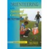
Orienteering in the National Curriculum for key stage 3 & 4, 2nd edition
This book provides teachers with a very practical guide to orienteering as an outdoor adventure activity in the school curriculum.
Contains 18 lesson plans plus a section on indoor activities and exercises.
Also includes How orienteering relates to the National Curriculum, Programmes of study, Assessment, Orienteering beyond the school.
Fully illustrated with clear line drawings
Produced in co-operation with the British Schools Association and the British Orienteering Federation
Size A4. 80 pages, paperback.
Technical Specification
- Scale: 1:40,000
- Ratio: 4cm = 1km
- Flat size: 696 x 486mm
- Folded size: 73 x 152mm
- Weight: 60gms
- Area of mapping: 600sqkm
- Double sided
To get pupils started practically, a beginner-friendly wrist compass like the Str8 First Wrist Compass is an excellent companion to these lesson plans.
HARVEY is a Scottish map publisher based in Doune, Perthshire, founded in 1977 by orienteers. It began by making orienteering maps and went on to publish its well-known walking, hill and fell running maps, alongside a range of navigation teaching materials.
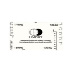
At Compass Point we stock HARVEY's teaching and navigation titles, written for teachers, outdoor tutors and anyone introducing navigation to young people. The Start Orienteering series gives ready-made games and activities by age group, from 8 to 9 year olds up to 10 to 12 year olds. Teaching Navigation and Outdoor Navigation, Handbook for Tutors cover practical ideas for outdoor instructors, and Orienteering in the National Curriculum supports Key Stage 3 and 4 lessons. The HARVEY romer and course template is a handy tool for measuring distances and drawing courses on a map.
You will find these titles in educational resources. Planning a first session? Pair them with school starter kits and our guide on how to use an orienteering compass.
Schools and clubs ordering several copies can contact us for larger quantities.





Reviews
There are no reviews yet.